Wild Stories
about the great outdoors
1,000 miles done
I stepped off the blacktop and climbed down into the ditch as yet another car passed me on the road out of Ironwood, Mich. One of the nicest days of the summer, I was walking along the road to the most popular county park in the area, Little Girl’s Point, which has a swimming beach on Lake Superior. Traffic streamed by me, making me nervous.
I discovered on this 40-mile roadwalk on the border of Michigan and Wisconsin that many vehicles veer into the oncoming traffic lane to give me space, which I appreciate, but also fear will cause an accident.
When people start telling me how dangerous bears and wolves are, I want to tell them the most dangerous part of this 2,400-mile hike is walking on roads.
Roadwalking can be stressful and unpleasant, but is necessary on a 4,600-mile trail of which only 2,600 miles of footpath have been built. Sometimes the trail has to run on roads around private land. The North Country Trail Association and local trail chapters are working every day to get more trail off the road. When all 4,600 miles are completed, and the NCT is as popular a thru-hiking trail as the Appalachian Trail, I’ll be a grizzled old hiker who’ll brag to the younger generation how I hiked the trail when it was only half done, and it felt like no one else was out there.
As the trail is not completed yet, no comprehensive guide has been written. The trail chapters provide a wealth of information, as do the maps, but sometimes I just have to figure things out as I go. On this roadwalk out of Ironwood, for example, I was having a difficult time finding water. Blazing hot, with little shade, my bottles were nearly dry when I spotted a sign that read “Park closes at 10 p.m.” There was no park sign, but I figured something had to be back there. I discovered a gorgeous little park on Spirit Lake with a swimming beach, picnic area, and latrine. I filtered water from the lake, then took a swim. 
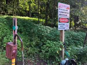
I’d been told about a natural spring up the road as well, but that test results had shown the water to be unpotable. The local chapter told me they thought the results were “spurious” as all the locals still drank from it.
I made it to the campground at Little Girl’s Point and lucked into a tent site right on the cliff above Lake Superior. This would be the last time I’d see the lake until I got to Duluth, Minn. about 300 miles up the trail. I watched the sunset, and woke before dawn to go down to the beach to watch the sun rise. No one else was up.

I reached the Michigan state border at 9:30 a.m. I took a break, got water, and mentally thanked all the trail angels who’d helped me in Michigan. After getting off trail in the Trap Hills, I’d felt like I’d never make it out of the Upper Peninsula.

As I neared my first Wisconsin town of Saxon, a nice couple in a van pulled over to let me know a severe storm with hail and strong winds was approaching from Ashland. They offered help, but I opted to just hurry the 1.5 miles left to town where there was a pub.
Thunder and lightning started cracking above me, and a downpour started just as I arrived in town. A gentleman working at the town garage told me we were on the very edge of the “red” of the storm, and 90-mile an hour winds had been reported. The pub hadn’t opened yet, but the staff invited me in early out of the rain. I watched the skies, now worried a storm was about to pull down trees across the trail and block my way. I ate a cheeseburger while the streets flooded with rain and listened to a group of local farmers discuss their work. No 90-mile an hour winds materialized, so I headed back out onto the road. I finished the 20 miles to Upson Lake, and camped.
I woke the next morning to condensation so thick, it dripped from the trees onto my tent like rain. Mist rose 20-feet off the lake, etherial, as I drank my morning coffee.

I was proud of myself for actually waking up before dawn a couple days in a row to give myself enough time to hike 20-miles a day, which is what I need to average to finish this hike by the end of October.
I planned to hike my longest day yet, 23 miles, to the Sandstone Ledges backpacking site in Copper Falls State Park. After just 5 miles of trail in the woods, I was back on the blacktop and melting in the full sunshine. I collected some water and decided to try a trick Jack, the man I’d met at Copper Peak, recommended. I took off my shirt, soaked it in the water, and put it back on. The cold shocked me and made me gasp, then rejoice as I cooled down. Traffic was much lighter on this stretch of rural road, so instead of staying “legal” and walking against traffic, I just walked in whatever side of the road had the most shade, and crossed to the other side whenever a car came in my lane. This also stopped drivers from feeling compelled to move into the oncoming traffic lane. Sometimes, I have to make the safest decision instead of following the rules.

I felt super strong heading into Copper Falls State Park, buoyed by my quicker pace for the day. “I can do 20 miles a day, no problem!” I thought.

I woke before dawn, sore and stiff, but in high spirits and feeling ready for another 20-mile day.
I passed another series of gorgeous waterfalls. Michigan gifted me a grand finale of waterfalls, and Wisconsin was welcoming me with another set.

By the time I hiked by Loon Lake, and took a swim with a group of loons bobbing in the middle of their namesake lake, I felt like a windup toy slowly winding down to a full stop. I dragged my way into the small town of Mellen, and bought an avocado, banana, yogurt, Gatorade, and ice cream to try and pep myself up for the remaining 14 miles into the Chequamegon National Forest. There wasn’t a motel in town, or I would’ve booked a room right then, I knew. I went to the local library to use their WiFi and discovered an invitation from Kristin and Jeff, two Chequamegon Chapter members, to stay with them and slack pack for a couple days. “This is why they’re called trail angels,” I thought, because my prayers had been answered just in the nick of time. I called Kristin and took her up on her offer, and decided to end my day early. I immediately started berating myself for not hiking further, at least a couple more miles instead of just surfing Facebook while stinking up the library. But I didn’t. Kristin picked me up a couple hours later. I showered, laundered, at a fantastic dinner with her and her husband, Jeff, and crashed.

I woke up at 5 a.m. determined to do the 20-mile day I’d failed to do the day before, but was realistic enough to make a Plan A and Plan B with Kristin, Plan B entailing ending my day earlier at 16 miles. I finished the last roadwalking until the west side of Wisconsin, and entered the Chequamegon National Forest on perfectly maintained trails. The only trouble in my day was at a bridge flooded by a new beaver dam. Crossing the bridge wasn’t the issue; the water was only a couple inches deep. I was deeply disappointed to see a warning from the USDA that snares and snap traps had been placed to kill the beavers. I believe to my bones that we humans are capable of finding ways to live comfortably alongside the critters who also call these forests home. I hiked angry for a while.
I saw my first elk tracks; there is a reintroduced herd in the area. Then I took a long break on the bridge over the beautiful Brunsweiler River.

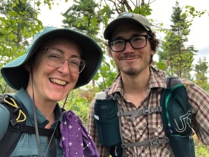
I met NCTA board member Jerry Fennell on the trail as well, and we had a long, joyful conversation about the NCT.
I hiked by Lake Three Campground and discovered it’d never been opened for the season. It looked like an abandoned ghost town. Later, Kristin told me the area had been hit by devastating storms in 2016 and 2018, and washed out so many roads in the national forest that funds were running short for other needs. The decision to kill the beavers made more sense. Building a new bridge probably wasn’t in the budget. Chequamegon is still recovering.
As I hiked, still feeling really tired, I decided to skip taking a rest day in the middle of Wisconsin and just hike lower miles to make it on time to Solon Springs, Wisc. I knew it was a risky decision, forgoing rest.
Kristin dropped me off with a plan to do a short day, then head to Cable to resupply. As I stood near the trail register, an unleashed dog charged me before its owner called it back and got it on a leash. As she came toward me, the dog charged me again, almost dragging her off her feet. I told the dog “No!” then backed away slowly. As I hiked away, I thought how lucky the dog owner was that I’m not someone terrified of dogs because there was a big, heavy wood walking stick leaning right beside me. If I’d been someone truly afraid of dogs, I could’ve hurt her animal badly by hitting it with that stick. The majority of my interactions with unleashed dogs on trail are positive, wiggling moments of joy. But sometimes I just have to shake my head when owners put their animal’s safety second to their own annoyance of hiking with a dog on a leash.
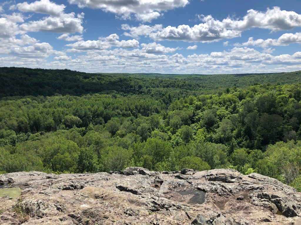
The forest quickly charmed me back into a good mood, and I really enjoyed the amazing overlooks on this stretch like Juniper’s Overlook.
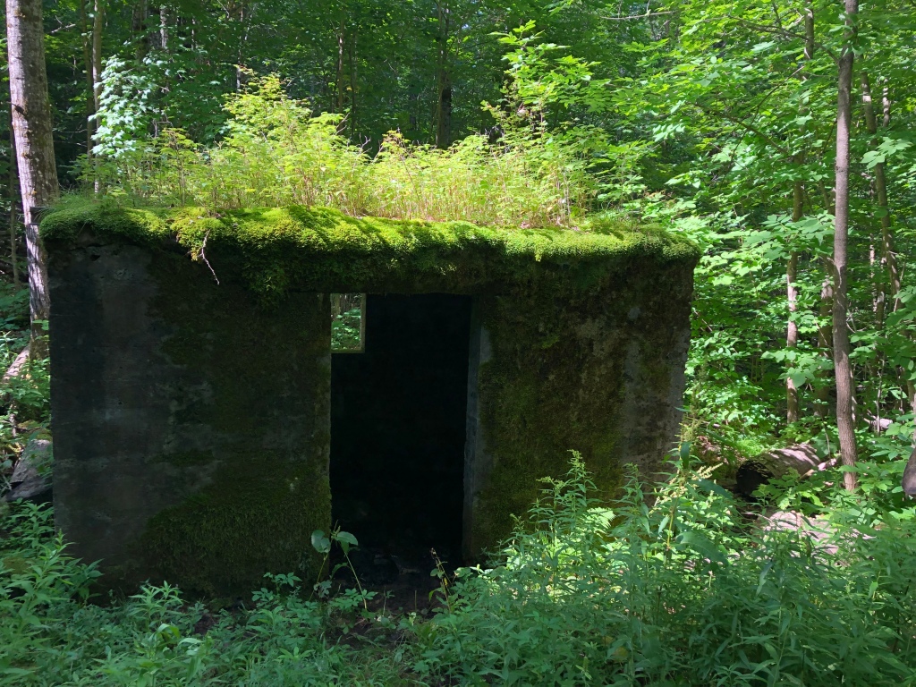
I was heading into Marengo Valley, home to the remnants of a Swedish settlement from the 1800s. I went up an old wagon track to find the stone foundation of a barn remaining, and the old spring house.
I hiked on and found Kristin hiking out to meet me, her bare legs covered in mosquitos, which had closed in again the closer I got to the Porcupine Lake Wilderness Area. We hiked fast back to the car, and drove to Cable for groceries and dinner at The Rivers Eatery for pizza, a restaurant owned by former Minnesotans, Beth and Mick. When Kristin told Mick I was halfway thru-hiking the trail, his eyes lit up and said I was doing his dream. He bought my dinner, and offered the use of the family’s cabin near the northern terminus of the SHT when I get there. I stood there, gobsmacked for a moment, before breaking out into a huge smile. I continue to be amazed by the generous support I’m getting on this hike.
The next morning, Jeff and Kristin drove me to the Drummond post office, bought me breakfast at Velo Cafe, and then dropped me off at the Porcupine Lake Wilderness trailhead. I was on my own until Solon Springs again. Planning a 15-mile day, I crossed paths with one of the only other backpackers I’ve seen on trail, Dustin. He was familiar with me already as he’d watched one of my videos after the NCTA published a story about my hike in their newsletter. We tried to chat for a while, but the mosquitos were tearing us to pieces. “They’re pretty bad for the next 20 miles,” Dustin said.
I hiked on, confident I could handle the bugs after the swarms of Bob Lake, Rock River Canyon, Tahquamenon State Park, and dozens of others. So I was shocked to find myself driven insane, panting as I ran up a trail lined by blackberry bushes tearing at my sleeves and skin, to emerge at the US-63 trailhead unable to get myself to go back into the woods. In Luke “Strider” Jordan’s book about his 2013 thru hike, he talks about sleeping in a latrine because the bugs were so bad. He talks about wanting to quit because the bugs were so bad. If there had been a latrine at that trailhead, I would’ve been in it.
I couldn’t figure out if the mosquitos were actually worse here, or I’d just finally hit my psychological limit in dealing with them. I seriously considered camping at the trailhead, which is not allowed, and not smart for a solo woman. In the open gravel parking lot, the mosquitos left me alone. I drank some water, calmed down a little, and put on my rain suit, the “nuclear option” for bugs. I found a clear space just off the trail for the night, also not allowed, I’m supposed to be 200 feet away, but it truly was the best I could do in my completely demoralized state.
Wisconsin is home to two breeds of mosquitos, one bigger and easier to thwart, which had been in Michigan, and another smaller, faster breed that could execute hairpin turns straight onto my neck like mini fighter pilots. They were somehow biting me in normally “safe” places like underneath my pack’s shoulder straps.
I had a fitful night of sleep as loud trucks passed on the highway, and set out the next morning wearing my full suit of rain gear. Ever seen boxers and wrestlers wearing plastic garbage bags while they work out to drop water weight? That’s what it felt like.
I crawled up the trail as sweat poured off of me, but the mosquitos were kept at bay. Eventually I had to take my rain gear off because I was overheating. This stretch of trail in the Porcupine and Rainbow Lakes Wildernesses offers some lovely hiking as you hike on perfectly clear trail from lake to lake, but I couldn’t enjoy most of it. My day became hiking as fast as I could from one forest road to the next, where I’d discovered earlier in my trip I could get some relief from the bugs by getting out into the open, and swatting to death the swarm around me. All I could think about was quitting the hike. For the first time, I just really did not want to be hiking anymore.
At beautiful Mirror Lake, I discovered I could kill the swarm and still take a break in the forest by the lake. This discovery really improved my day, but my mood was still black.

I’d crossed the 1,000-mile mark that morning, and was pissed that instead of feeling empowered by that milestone, I was camped out by Tower Lake, miserable. I’d only managed to hike 10 miles that day.
I resolved to go to bed early, suspecting my decision to forgo a rest day was what was causing my dark mood. Tower Lake was brimming with life, and quiet. Trumpeter swans, bullfrogs, a loon, owls, and a hummingbird kept me company. I woke feeling refreshed, and much more positive. And also vindictive: There was no way I was going to quit this hike before the bugs do. I’m determined to outlast them.
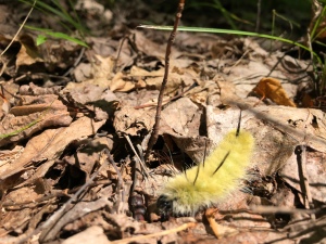
As I exited the Rainbow Lake Wilderness, the terrain changes and got much drier, and the cloud of tiny vampires that had been chasing me disappeared. Gleeful, I walked mindfully through the forest, able to enjoy it again. I found porcupine quills in the trail, noticed some foliage already changing to their fall colors, and delighted in a fuzzy, yellow caterpillar that crawled by me.
Just after crossing into the Bayfield County Forest, I met Swan on the trail, another backpacker. Swan is from Minnesota and offered to help me slack pack a 30-mile roadwalk west of Solon Springs.
I reached an established campsite on the beautiful Erick Lake early in the evening, all memory of wanting to quit banished from an amazing, bug-free day on trail. I had only 35 miles remaining to Solon Springs, and a reunion with Kim and Carrie, two women with whom I’d previously backpacked on the Superior Hiking Trail. I planned to cover 20 of those miles tomorrow. After eating dinner by the lake as a light rain fell, protected by the canopy of white pines, I went to bed.
I woke to a beaver tail-slapping on the lake, eager to get moving. I hiked toward the Brule River Valley. Having entered into the Brule St. Croix Chapter’s territory, I started to notice some differences: this chapter loves giving hikers beautiful views. They place hand-made benches a regular intervals, and clear vistas, one of my favorites overlooking Hoo Doo Lake.
I ran into Dustin again near an active logging operation. As heavy machinery growled in the background, we had a longer conversation, free from the bugs. He’d finished his first hike, then gone further west and hiked back east again, which is how he intercepted me twice. “You’re in for a treat,” he said of the trail ahead of me, making sure to highlight an artesian well near a historic portage.
I enjoyed every view, and the amazing condition of the trail. I became mystified by giant holes dug along the trail. I was dying to know what animal was doing it. Badger? Bear? I spooked something really big and it went crashing through the woods, setting my heart racing. I got to camp as dusk was falling, the wind in the pines lulling me to sleep.
Eager to hike a 400-year-old portage used by American Indians and Voyageurs, I headed out. The portage is lined with stones emblazoned with the names of voyageurs, and the chapter has a pamphlet with information that I downloaded to my phone. Apparently Michel Curot wasn’t a very good fur trader, kept getting cheated in deals, and then died an early death. As I walked, I wondered what it was like to carry 150-pound packs of furs up the hill causing me to pant with a 30-pound pack.
I took a long lunch at the St. Croix Landing with the artesian well, even calling my mom for a long talk. I lay in the shade, on the grass, next to the river and took a short cat nap. I was hiking tired. My calorie deficit at the end of a stretch is so great, my hunger is endless. I eat, and five minutes later I’m starving and flatlining on trail.
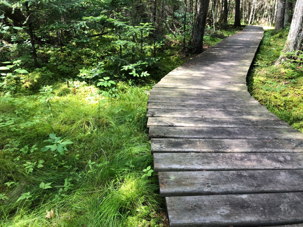
I headed down the Brule Bog Boardwalk, a feat of trail engineering.
After the bog, the trail jumped on and off of roads, then back on short stretches of trail. I was so impressed by the established backpacking sites, which were spread out every few miles, making them great for both section hikers and long-distance hikers.
I made it to Lucius Woods County Park as a train blew its horn over and over as it went through town. So loud, my nerves jangled, and I sighed as I immediately missed the quiet of the forest. Kim and Carrie pulled up, and we drove south to Kim’s house for dinner and chatting until almost 10 p.m.
I’m stressing about the roadwalk to the Minnesota border, but I only have a couple more days of hiking in Wisconsin. I am so excited to get to my home state of Minnesota.
Section: Ironwood, MI to Solon Springs, WI
Miles: 163
Total: 1,056

We managed to keep going in North Dakota in July only by soaking our shirts like that. And I have pictures of many of these same places! You’re doing great.
LikeLike
Your posts are so finely written and make delightful reading. What an inspiration to the rest of us hikers while we wait for our days on the trail. Thank you.
LikeLike
Thank you so much, Susan! I hope you get on trail soon.
LikeLike
I love that little town of Mellen!
LikeLike
I wanted to hang in that library and read all their books for a week.
LikeLike
those darn bugs are still there , Huh !!!! I thought we killed a whole generation …you are really tough…keep pushing on and eat good stuff…sugar seems good but runs out quickly…bon voyage
LikeLike
Thanks, Marie! The bugs eased up as soon as I got out of that wilderness area. I will keep eating good stuff (she says while drinking a cup of coffee and eating a Snickers bar).
LikeLike
I envy your determination to make this a reality in your life, Annie. It’s really inspiring to read of your adventures on the trail. I’ll see you when the chill of winter starts to arrive again. 😉
LikeLike
Thanks, Johnny! I was trying to put into words for myself what exactly I find out here, and failing. I’m glad some of it is coming through my writing. I’ll see you after the snow flies! 😁
LikeLike